Mýrdalsjökull Travel Guide
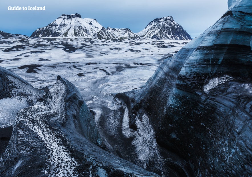
Mýrdalsjökull is a glacier in the south of the Icelandic highlands. It is the country's fourth largest ice cap, covering nearly 600 square kilometres (232 square miles), and its highest peak is almost 1500 meters tall. It is most well-known for sitting atop the notorious and explosive volcano, Katla.
Day tours, especially South Coast tours, will introduce you to this glacier, and you can also witness it on many summer vacation packages, such as this 6-Day Holiday. Those who rent a car can seek it out independently.
Mýrdalsjökull is visible from Route 1 on the South Coast, sitting to the north of the village of Vík. It is visited on some snowmobiling, ice caving and helicopter tours, and one of its glacial outlets, Sólheimajökull, is the most popular place in the country for ice-climbing and glacier hiking.
Eruptions beneath Myrdalsjokull
Since 2010, the world has known of the volcano beneath Eyjafjallajökull; after all, it halted European air travel for over a week and stumped news readers everywhere. Few, however, are aware of the much larger volcano right beside it.
Mýrdalsjökull conceals Katla, one of the country’s most active volcanoes, having erupted, on average, once every fifty years since 930 AD. Because of the glacier above it, these eruptions tend to cause enormous ash clouds. It is these ash clouds that lead to flights being grounded, crops and livestock poisoned, and have the potential to change the world’s climate.
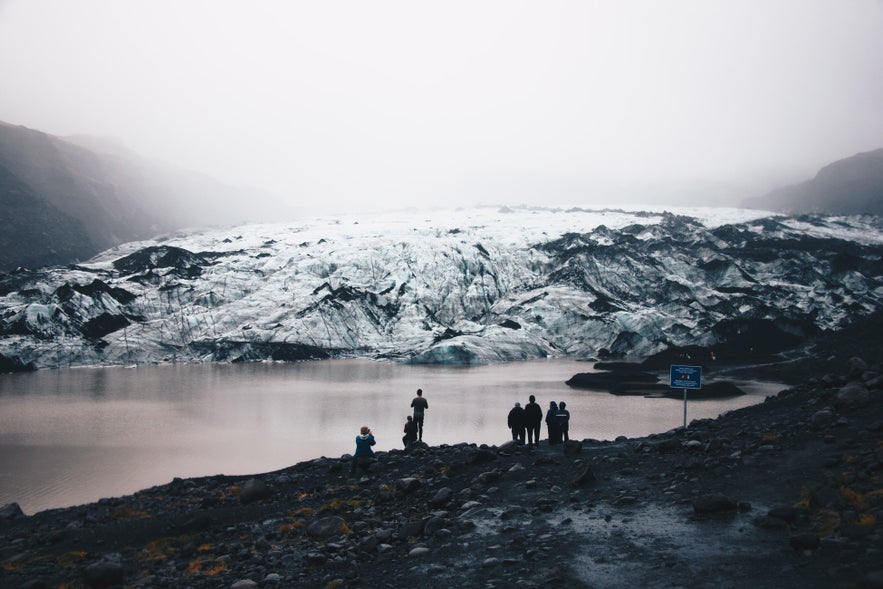 Photo by Ruslan Valeev
The last major eruption beneath Katla was in 1918, in which such huge lahar floods occurred that the southern coastline was extended five kilometres outwards. This area is also very susceptible to glacial floods, or 'jökulhlaup', during eruptions, even when the lava does not break through the surface of the ice. These are as dangerous as the lava itself, having wiped out whole Icelandic villages before.
Historically, the area was little settled for this reason.
Katla is connected to the same volcanic system as Eyjafjallajökull and usually erupts violently a few years after Eyjafjallajökull does. As the ex-president, Ólafur Ragnar Grímsson said in 2010:
So it is currently several years overdue. Katla is monitored heavily, and roads around it closed when seismic activity increases. All road closures around Iceland can be found on Road and Coastal Administration's website.
Tours on Myrdalsjokull
While there are no eruptions immediately imminent, tours continue to run on Mýrdalsjökull, allowing visitors to enjoy the glacier. It is, for example, possible to snowmobile across its surface and take ice caving tours beneath it throughout the year, with departures from both Reykjavík and Vík.
Considering the ice caves under Vatnajökull glacier are usually only accessible from November to March, this provides a wider window of opportunity for travellers to Iceland outside of the depths of winter. It should be noted that the caves in Mýrdalsjökull do not have the same blue ice, however.
Tours around Myrdalsjokull
Mýrdalsjökull can be seen on all South Coast tours that reach Vík and beyond in clear weather. It can also be seen from above on helicopter tours that depart from Reykjavík.
The best perspectives of the glacier, however, can be found on the popular Fimmvörðuháls hiking trail, which goes between Eyjafjallajökull and Mýrdalsjökull. Part of this hike can be done in a day, or you can take the complete route from Þórsmörk to Skógar on a three-day trek.
Attractions Nearby
Popular categories

Download Iceland’s biggest travel marketplace to your phone to manage your entire trip in one place
Scan this QR code with your phone camera and press the link that appears to add Iceland’s biggest travel marketplace into your pocket. Enter your phone number or email address to receive an SMS or email with the download link.

